Showing posts with label Cartography. Show all posts

Saturday, 3 January 2009

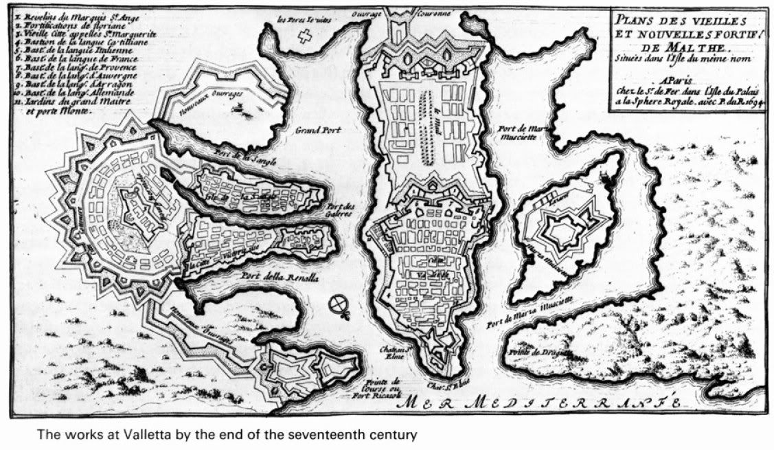
Valletta Cartography


A splendid chart of the home of Vanvlak Industries, just for Mssr V!

Wednesday, 24 September 2008

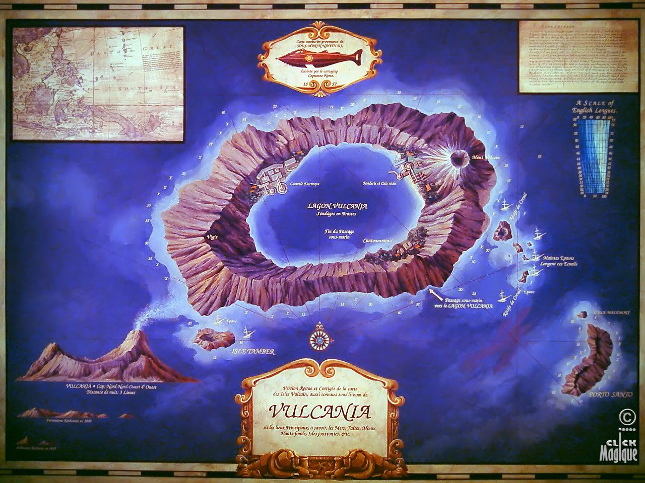
Vulcania

I got this wonderful chart of Vulcania from the nice chaps at Disney - thank you indeed kind Sirs!


click here for full version: http://s35.photobucket.com/albums/d170/pauljamesog/Aeronef/?action=view&current=Vulcnia.jpg

I've always wanted to make a model of this - perhaps it would make a good Chritsmas holiday project, but I think the addition of a drigible pad would also be prudent!

Sunday, 30 December 2007

National Geographic Map Collection


Over a hundred years of searchable, zoom-able maps here - just the thing for planning an expedition or next season's campaign!

http://www.ngmapcollection.com/

Tuesday, 4 December 2007

Google Mars

This is a new project by Google Labs; you can use it to view some of the most detailed maps of Mars created by NASA scientists. Select between visible and IR, show elevations or other terrain features.

This will be excellent for mapping areas for Redcoats to explore and claim in the name of Her Britannic majesty!

http://www.google.com/mars/

Friday, 12 October 2007

Don't try this at home...


The above image shows the collapse of the Ottoman Empire to nearly-modern Turkey. The animation runs from 1870 to 1923 and displays British, French, and — eventually — Italian territories as the Turks decline. The original images were taken from the WHKMLA Historical Atlas - http://www.zum.de/whkmla/histatlas/asia/haxwasia.html - which may be the most useful collection of summary maps I have ever discovered.

Thursday, 27 September 2007

Æther, the final frontier...


We seem to be in an ethereal mood. This detail of a work-in-progress demonstrates how far each planet (out to Jupiter) will travel in a terrestrial month. It is, of course, simplified and loses track of precise location after about two years. The larger spaces on each orbit roughly shows the real positions of the planets in the middle of January in 1899. All of the planets shown move one space counter-clockwise per month.

The work-in-progress image shows the full orbit of Jupiter (so you can imagine its size). Reaction to this post will guide the direction of the project.

Monday, 24 September 2007

Stellar Cartography

With Astronef on the horizon (relatively speaking) Tas and I got to talking about a map. After some consideration of how to make something like this - http://sajri.astronomy.cz/asteroidgroups/hildatroj.gif - a game aid (with tokens and spaces), I have decided that the most useful Astronef game map would show Jupiter with Io, Europa, Ganymede, and Callisto. This map is in progress and should be posted soon.

My decision not to show the solar system (at least as far as Jupiter) was not merely based on simplicity. Tas believes that most of the interaction in Astronef will be a much more limited scale. If you are engaging and enemy near Deimos, it will not matter if he has additional ships deployed near Mercury.

Still, you owe it to yourself and your crew to visit the link above included.


Reply by Tas:
I envision an azimtuh projection of the Inner planets, but cenetred on Earth not the Sun. The idea being it would be an Astrogator's chart for navigating from Earth to other destinations (which are depcted in their relative motion to earth). There would then theoretically be a correspnding chart for each of the destination to return.

Idea floated so far are a Stellar Meridian (for standard emasrement of time) and units of measurement being Aetherial Leagues.
Monday, 17 September 2007

Verne Cartographies

After much searching I have finally found a chart showing the track of the Nautilus in 20,000 Leagues under the Sea. Its not very clear, but that has a charm of its own.


I found the map here, which links you to some fascinating articles about Jules Verne and his works.

http://jv.gilead.org.il/sfs/Harpold/#figure3

Still, if you happen to see a bigger or clearer version , please let me know.


And if you havent seen them before, here are some fantastic collection of maps of the heroes travels in Voyages Extraordinaires:

http://www.phys.uu.nl/~gdevries/maps/maps.cgi

Thursday, 13 September 2007

Strange Maps

Any Aeronef Captain, Ironclad Commander or Aquanef Navigator worth their salt spends hours pouring over various charts and maps. And the weirder and more mysterious the better I say!
This website is a treasure trove of all sorts of very interesting geographic displays - not just old maritime charts but, maps with different representations of the same old shapes youve always looked at.

Go have a look and see what I mean! Its intriguing:

And I'm still looking for a chart of Captain's Nemo's track in 20,000 Leagues Under the Sea by the way...

Tuesday, 30 January 2007

ERB Map Room

If you are visiting this Blog, you are probably an Edgar Rice Burroughs fan and already have a few of his works in your library or parlour.

So, being an erudite gentlemen smoking a thin pantella, its time to don your smoking jacket, pour out a snifter of cognac and visit this site with some great maps of Barsoom and Pellucidar.

http://erbatlas.virtualave.net/atlas1.shtml

Monday, 25 December 2006

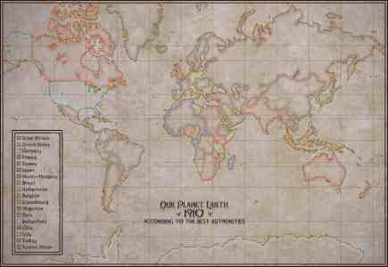
Aeronef World Map Project

Tying very neatly into my post yesterday on the "Invasion of 1910" book, Zophiel has started a project to map the world as it stands in 1910 in the Nef universe background. I'm sure you'll agree it has a great feel of authenticity.


You can see the full version and thread on the Brigade Model forums here:
http://www.brigademodels.co.uk/phpBB2/viewtopic.php?t=419
He would love to hear your feedback and input


An exploration of debauchery, vice and other reasons to be a man!

An exploration of debauchery, vice and other reasons to be a man!